Paradigm Geolog 18

geolog18.0

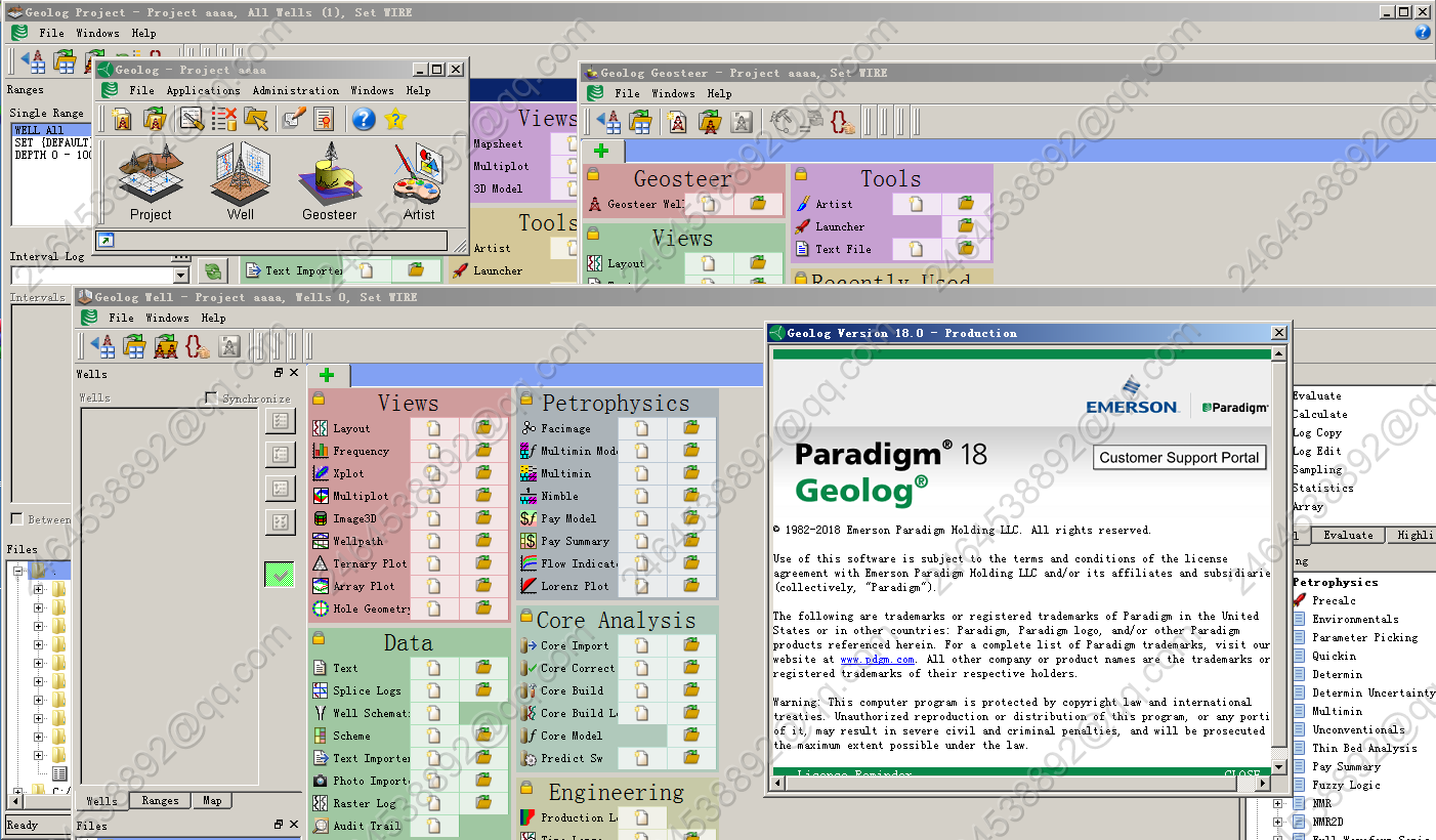
Geolog includes many new features and enhancements to improve the user experience and increase productivity. Selected highlights are briefly described below. Generalized Monte Carlo uncertainty functionality has been added to Geolog’s module launcher interface, allowing users to evaluate the impact of input parameter variation on the results from calculations. This functionality works on both modules supplied with Geolog and any locally created custom modules that the user has created (without the need for any additional coding). New Formation Test QA / QC views have are available in Geolog which enable users to rapidly load, display and assess the quality of pressure tests and integrate these measurements with other forms of borehole data to improve overall reservoir understanding. Geolog introduces a new automatic report generation tool which allows users to create custom report templates featuring text, tables and live graphical views which can be saved and used to deliver consistent reports in a high quality format across multiple wells, projects and sites. Geolog has traditionally provided a range of customization options and the latest release sees this further enhanced by the inclusion of the ability to access Python scripts from Loglan. This functionality enables direct access to a wide variety of third party libraries for statistical analysis (e.g., pandas) and machine learning (e.g., TensorFlow).

发表在 钻井测井软件 | 标签为 , , , , | Paradigm Geolog 18已关闭评论

Rokdoc 6.6.2 岩石物理软件

Rokdoc6.6.2_218_welltie_a Rokdoc6.6.2_218_welltie_b Rokdoc6.6.2_218a Rokdoc6.6.2_218b

 DEF-15019: when exporting TVDss-TWT conversions to Petrel, TVDss depth used instead of
the converted TVDss to MD depth that Petrel required – resolved
 DEF-10764: WellTie crashes when duplicate volumes names used – resolved
 DEF-13918: Interconnector fails to recognise seismic phase template for seismic – resolved
 DEF-14652: if crop values are followed by a change to the selected volumes, crop values are
reset to the overall geometry – resolved
 DEF-14037: for RokDoc launched via Petrel ‘open RokDoc project’ option, any RokDoc-2D
quantities generated are not exportable back to Petrel – resolved
 DEF-15043: for seismic cropped and/or decimated during 2D/3D modelling; if start/stop and
sampling is not coincident with original sampling, sample rate in RokDoc is different – resolved
 DEF-15044: 3D modelling cannot be started if RokDoc believes model start Z is less than
minimum caused by switching between different surveys and depth intervals – resolved
 DEF-14644: 3D modelling results in erroneous duplicate model logs – resolved
 DEF-15042: picking a new horizon during 3D modelling results in the horizon transferring to
RokDoc in time domain regardless if new horizon is depth domain – resolved
 DEF-15060: file already closed for writing; error assigning traces to SEGY – resolved
 DEF-15206: transferred position sets have TVDss values instead of TVDkb values – resolved
 D-47658: wavelet extraction & 3D modelling crash if duplicate horizon names used – resolved
 D-47678: transferring seismic volumes to Petrel with steps greater than one incorrectly
populated – resolved

发表在 其它, 正演反演软件 | 标签为 , , | Rokdoc 6.6.2 岩石物理软件已关闭评论

Lead 3.0 LEAD3.0测井处理解释一体化软件

lead3.0

发表在 钻井测井软件 | 标签为 , , | Lead 3.0 LEAD3.0测井处理解释一体化软件已关闭评论

JewelSuite 2017

joa_GeoMechanics2017 joa_Subsurface_Modeling2017


JewelSuite 2017.2 GeoMechanics

JewelSuite 2017.4 Subsurface Modeling

发表在 地质建模软件 | 标签为 , , | JewelSuite 2017已关闭评论

promax 5000.10.0.3

promax5000.10.0.3a

发表在 地震资料处理软件 | 标签为 , , , , | promax 5000.10.0.3已关闭评论

discovery2019.1

discovery2019.1

What’s New in 2019.1?

LMKR is pleased to announce the release of GVERSE NOW, a web-based launch platform for all GeoGraphix and GVERSE applications. GVERSE NOW provides instant access to GeoGraphix and GVERSE support, documentation, white papers, training schedules, webinars, software downloads, and release and user group announcements. The ultimate goal in building GVERSE NOW is to put the entire range of LMKR resources at your fingertips – so you get the support and information you need – when you need it.

What’s New in 2017.3?

The following is a summary of the new features added to GeoGraphix Release 2017.3.

Architecture

ESRI ArcGIS Runtime Engine 10.5.1

ESRI ArcGIS Runtime Engine 10.5.1 is supported in this release.

Advanced Database Security

All users are now logged into the database using their active directory credentials instead of the default user ID and password. This enables you to trace transactions performed on the database for auditing purposes.

Microsoft Office 2016

Support for Microsoft Office 2016 (32-bit and 64-bit) is added.

发表在 地震资料解释软件 | 标签为 , , , , | discovery2019.1已关闭评论

simics 4.8

simics4.8

http://www.eetop.cn/blog/html/28/1066428-type-bbs-view-myfav.html

http://blog.sina.com.cn/s/blog_5386d7f90102w9o0.html

Simics 4.0的Decryption Key:

========================================

1000 Simics-Base 57463084538ae53b2d0132814092ed17

1010 Model-Builder 68ffab9834e60b7d01650eea8fb9821b

2007 Leon2-Simple e8fe7671cb60cc351e40a62457b4de76

2010 MPC8641                 028fb9bf9cb174fb5582af304eaff213

2011 Niagara-Simple bd0e9bc34ec1c248b0f52c7c567bfbb4

2012 PPC-Simple 143c47eb841090079ef7f7d4bf2be3d8

2015 Serengeti                16fcede6085681a322bc515c80c2841e

2016 Sunfire                680a76fc09b1308422828be9145a721b

2018 X86-440BX 8dbf0dcb45c7b77b9803e4250426211f

2035 TS7200               220ccc837e46e0d10d6b97e7672866fa

2036 Ebony               02f1022836841ca1584c1f3af802d0fb

4005 Firststeps   e5b74deb275a1e4b5098649970dbc6cb

========================================

Simics 4.6的Key:

========================================

1000 6467e8215902d9c233897e1d970095e8

2071 0c536140195be184c6138145e43bede6

4030 1268c60e313093ab9b890872c301ec77

========================================

Simics 4.8的Key:

========================================

1000 48f1b619e15ba241ab7df6d5940e4204

Simics 4.x 安装文件下载地址:

http://download.simics.net/pub/simics/4.2_krg956/

http://download.simics.net/pub/simics/4.4_asp861/

http://download.simics.net/pub/simics/4.6_wzl263/

http://download.simics.net/pub/simics/4.8_fcd175/

点这里下载补丁文件

发表在 其它 | 标签为 , , | simics 4.8已关闭评论

Emeraude v5.20 生产测井解释软件

Emeraudev5.20

Production logs, or PLs, are run on production or injection wells, with the goal of evaluating the well itself and/or the reservoir performance. Put simply, for producing wells, we need to determine what fluid is coming from which zone, and how much. The PL string may be a relatively simple, conventional configuration run in vertical or deviated wells that, based on the assumption the tool is centralised in the flow, measures the bulk flowrate using a calibrated spinner and then discriminates the fluid type(s) using a suite of tools usually including density, pressure and temperature applied to flow correlations in Emeraude.

With the proliferation of horizontal wells in recent years the PL strings have, by necessity, become increasingly complex. The challenge is to handle segregated flow by various distributed measurements around and across the section of the pipe. Emeraude has kept pace with these developments and offers a choice of calculation schemes and visualisation options to cope with these multiple array tools from any vendor.

Emeraude,法国KAPPA公司力作,该软件已经过二十多年的发展、完善和考验,不断吸收最新科技发展成果,是一款成熟的生产测井资料解释软件。

国际上通用的生产测井资料解释软件,目前只此一款,它也是唯一实现大斜度井、水平井等复杂井况准确解释的软件工具。

大斜度井、水平井下的多臂仪器测试

发表在 其它 | 标签为 , , | Emeraude v5.20 生产测井解释软件已关闭评论

辅助历史拟合软件SenEx2.0.40

SenEx1.1 SenEx软件功能及特色

SenEx(Sensitivity Explorer)软件是东营康帕斯石油科技有限公司旗下基于微机上使用的一套“辅助快速历史拟合软件”。该软件在敏感性参数分析方面有其独特之处,主要特点有以下几方面:

1).SenEx软件利用特征方程近似解来计算流体流动方程,通过这种方式计算出来的参数敏感性分析结果是准确并有效的。

2). 在进行敏感性参数分析过程中,由于需要考虑多种敏感性参数,研究人员在很大程度上不能直观地判断参数的敏感性如何?使得参数的挑选过程即费时又繁琐。如果对整个油藏属性不熟悉的话, 往往会因为选择参数的失误而对整个模拟的效果产生非常大的影响。

对于SenEx软件来说,不需要预先对所有参数进行分类排序后再进行敏感性参数分析,可以直接将所有参数进行敏感性分析。该软件有效的计算了所有地质模型参数的敏感性,能够给用户提供全面的图形来显示这些敏感性分析的结果。

3). 在敏感性分析过程中,网格数量的大小以及参数选择的多少直接影响了敏感性参数分析的速度, SenEx软件可以处理数量非常多的参数,在处理过程中对每一个属性 (比如孔隙度渗透率等) 在每一个网格处被认为是一个参数,通过软件处理的参数数量要几倍于网格数据 (超过数十万甚至上百万)。这种对网格数量的可接受程度以及非常方便的操作功能是其它类产品无法比拟的.与此同时,软件在敏感性分析计算完成之后,还可对其它外部的一些参数(比如盒子乘法器)也都可以在不需要重复模拟的情况下进行快速的处理分析。

4)SenEx软件一次模拟过程就可以对所有的地质模型参数进行敏感性分析,同时能够帮助保存模型的地质特征。其它产品对一个参数进行敏感性分析至少需要进行2次模拟过程,比如说,为了评价一个断层盒子乘法器的敏感性,第一次模拟需要设置一个高值(比如1.0),第二次模拟需要设置一个低值(0.01),以这种方式来查看不同的数值在匹配程度上的区别,然而在实际当中,很多地质问题都是非线性的,依靠这种两次模拟得到的结果在很大程度上是无效的,并且也是不准确的。

5) 软件通过设置全局参数以及局部参数的方式,可以同时对所有的井进行匹配程度的改进。其它产品多数不能够对所有的井同时进行改进。

6) 软件通过较少的模拟次数提供高质量的敏感性参数分析效果

   软件在要求非常少的模拟次数就可以提供非常高质量的敏感性参数分析效果,以便达到实际应用的要求。而其它类产品对有限的模型参数进行敏感性分析需要上百次的模拟计算,这个过程过于复杂和漫长。

发表在 正演反演软件 | 标签为 , , | 辅助历史拟合软件SenEx2.0.40已关闭评论

tNavigator 18.4

tNavigator18.4a

1. tNavigator 18.4

The key new features in 18.4 are:
• In tNavigator kernel:
– Local grid refinements getting progressively finer in the vicinity of the fracture are
introduced for XYZ fractures.
– Default setting of results saving was changed. For models in E1/E3 format, if
none of the command line options or keywords (RPTRST, etc.) related to selective
writing of the results are specified, the grid properties will be recorded only on the
first and last step. Previously in this case all grid properties got recorded on all
steps. For models in IM, ST, GE formats the grid properties are still recorded on
all steps.
• In Geology Designer:
– Grid coarsening with corresponding property upscaling is introduced.
– The Multi Point Simulation computation is available, which allows to perform the
interpolation by using multi point statistics method.
– The possibility to perform a fluid in place estimation for a 2D surface is available.
– The possibility to compute seismic attributes and transfer them on geological grids
is available.
• In Model Designer:
– Import of hydraulic fracture data in GOHFER format.
– Entering of hydraulic fracture parameters in tabular form.
• In PVT Designer: thermal variants are supported.
• In VFP Designer: Integration with Model Designer is supported. Each well in the Model
Designer corresponds to a project in VFP Designer.
• In Assisted History Matching and Uncertainty: multitarget optimization by particle
swarm method is supported.
• In Network Designer: Integration with Model Designer is supported. When a dynamic
model is loaded to Model Designer, a corresponding Network Designer project is created
automatically.

发表在 数值模拟软件 | 标签为 , , , | tNavigator 18.4已关闭评论

jason10.0.1

jason10bjason10

发表在 正演反演软件 | 标签为 , , , , , | jason10.0.1已关闭评论

GeoEast-EasyTrack触控解释软件

easytrack2.5.x

性能指标:

   GeoEast-EasyTrack软件是中国石油集团具有自主知识产权的地震资料解释软件。软件能够满足常规地震数据,宽方位高密度数据解释,在常规构造高效解释、裂缝检测、方位各向异性解释方面有特色。实际生产证明,该软件能较好地满足常规三维地震数据、高密度宽方位数据等地震资料解释工作,具有安装简单,解释效率高、用户体验好等特点。

技术特点(特色优势):

   GeoEast-EasyTrack软件系统包含11项特色技术系列,包含TB级海量叠前数据的高效管理与计算,碳酸盐岩缝洞雕刻,基于优化模板的叠前数据分析,高精度裂缝预测,地质体与概率体自动识别,基于OSG技术的三维可视化显示,地理信息在线、离线显示等多个特色功能模块。

效果展示:

   为了配合”两宽一高”采集、OVT域处理获得的海量地震数据,满足五维道集解释需求,提升叠前解释能力,开发了一套基于五维道集的解释软件,重点聚焦叠前五维解释(地质目标成像、FRC、AVA、AVAz、FVA、FVAz等)、频率域解释、地质体雕刻、属性融合等领域。

TB级海量五维道集数据管理,点、线、面、体联动解释,多线程并行计算,插件管理,跨平台(Windows、Linux)运行,一键式安装,特色的触摸屏控制,中英文软件界面,方便用户使用

充分利用高质量OVT域处理五维道集数据成果的入射角(偏移距)信息和方位信息,开展基于振幅和走时的叠前各向异性裂缝预测,定量预测裂缝方向和裂缝密度,提高裂缝预测精度。

针对埋深、断层走向、砂体展布等实际地质目标特征及强干扰区域、方位信噪比、频率衰减、远道拉伸畸变等叠前道集特征对叠加成像的影响,提出了基于批量叠加模板、分区域叠加模板和交互数据刷道集叠加技术,改善了叠加成像效果,进而提高了属性分析精度。

发表在 地震资料解释软件, 正演反演软件 | 标签为 , , , , , , | GeoEast-EasyTrack触控解释软件已关闭评论

hrs 10.4.1

hrs10.4.1

发表在 正演反演软件 | 标签为 , , , , | hrs 10.4.1已关闭评论

Landmark EDT 5000.15.1

EDT15.1_CasingSeat EDT15.1_CasingWear EDT15.1_COMPASS EDT15.1_DataAnalyzer EDT15.1_openwell EDT15.1_PROFILE EDT15.1_StressCheck EDT15.1_WELLCAT EDT15.1_WELLCost EDT15.1_wellplan

The Computerized Planning and Analysis Survey System (COMPASS) is a comprehensive software tool designed for use in directional well design by either oil companies or directional contractors. COMPASS is a tool that enables you to quickly and accurately plan wells and identify potential problems at the earliest possible stage.

All of the features for complex well trajectory design, monitoring and analysis are included. The list of features include survey and planning methods, torque-drag optimization, anti-collision plotting with traveling cylinder and ellipse of uncertainty.

COMPASS consists of three main function areas (Survey, Planning, Anticollision), as well as an extensive plotting tool.


WellPlan™ is drilling, completion and well service operations engineering software. WellPlan™ software can be used at the rig site and in the office to provide integration between engineering functions.

WellPlan™ software is based on a database and data structure common to many of Landmark’s drilling applications. This database is called the Engineer’s Drilling Data Model™ (EDM™) and supports the different levels of data that are required to use the drilling software. This is a significant advantage while using the software because of improved integration between drilling software products. Currently WellPlan™, COMPASS, StressCheck, CasingSeat, WELLCAT and CasingWear software use the common database and data structure.

Drilling oil and gas wells is a very complex and expensive proposition. Drilling costs generally account for a major capital expenditure for an operating company. In today’s competitive environment, companies are facing increasing numbers of technical challenges. Deepwater drilling, extended-reach drilling, slim-hole drilling, underbalanced drilling, and environmentally sensitive drilling areas are a few of these challenges. WellPlan™ software is the drilling engineering software that provides you with the competitive edge to help solve engineering problems during the design and operational phases for drilling and well completion.

The new results-oriented user interface offers more efficient analysis using only necessary inputs, saving time, and minimizing analysis steps. WellPlan™ is integrated with the other EDT™ applications enabling you to install it on the same computer or server in multi-user environments, and share data with other EDT™ software applications.


发表在 钻井测井软件 | 标签为 , , , , | Landmark EDT 5000.15.1已关闭评论

Landmark EDT 5000.15.0

EDT15.0_CasingSeat EDT15.0_CasingWear EDT15.0_COMPASS EDT15.0_DataAnalyzer EDT15.0_EDM_AutoSyncClient EDT15.0_openwell EDT15.0_PROFILE EDT15.0_StressCheck EDT15.0_WELLCAT EDT15.0_wellplan

发表在 钻井测井软件 | 标签为 , , , | Landmark EDT 5000.15.0已关闭评论

perform 2013

PERFORM2013

发表在 其它 | perform 2013已关闭评论

DecisionSpace_Geosciences-10ep.4.03_G1

DSG_G1_4.03 DSGEP_G1_4.03b

The DecisionSpace® Geosciences application is a unified visualization, interpretation, and modeling workspace where asset teams can collaborate more effectively to evaluate and develop assets. It delivers a true multi-user environment with unprecedented integration across multi-domain workflows and data types—all on the award winning, data management foundation of Landmark OpenWorks®—that enables asset teams to better understand and utilize geoscience data.

The unified visualization environment and enterprise-scalable data management enable asset teams to use their collective expertise to more quickly evaluate large data sets for hydrocarbon potential, more thoroughly understand uncertainty, better quantify risk at the basin or reservoir scale, and improve production through refined reservoir models and effective well plans.

DecisionSpace® Geosciences workflows can lead to better technical and business decisions in less time, and can lower Finding and Development costs in the face of smaller, deeper, more complex reservoirs and unconventional resource challenges.

DecisionSpace® Geosciences Application Overview
This software provides a user-friendly interface from which to work. Across the various modules associated with different Perspectives, the workspace provides common, flexible 1D, 2D, and 3D views to support standard workflows–seismic, logs, maps, cross sections, cubes, and more.

•1D (section and well Correlation editors)

•2D (map and cross section)

•3D (cube)

•2D and 3D Seismic and GeoProbe volumes

Data can be loaded into the OpenWorks® database via that software’s interface and can also be loaded through DecisionSpace® modules. This data, and all interpretations associated with it, can be shared across teams and groups. Data interpretation occurs across all modules with the optics flowing from horizon and fault interpretation through to flow simulation at the reservoir level. The analysis scale is from wellbore to basin.

Additionally, a local database can be established, along with a local license, that allows you to work in the field independent of a corporate network.

Each Perspective, or module/selection of modules, is geared towards a scientific or engineering domain, for example Geology, Geophysics, and Well Planning to name a few.

发表在 地震资料解释软件 | 标签为 , , , | DecisionSpace_Geosciences-10ep.4.03_G1已关闭评论

PetroAnalyst 2014

PetroAnalyst2014

PetroAnalyst is a play fairway mapping software and process that allows the consistent and efficient spatial evaluation of geologic uncertainty in all types of plays, conventional and unconventional.

Common Risk Segment, representing the relative uncertainty associated with all components of the petroleum system, can be quickly created from grids, shapefiles or gross depositional environment (GDE) maps.

The Data Evaluation Tool allows you to create maps of data confidence based on the quality and quantity of data available when evaluating your play.

发表在 地震资料解释软件, 绘图成图 | 标签为 , , , | PetroAnalyst 2014已关闭评论

JewelSuite GeoMechanics 2016.1.364 6.1

joaGeometh

JewelSuite由Baker Hughes,a GE company(贝克休斯)公司研发,是一款以三维地质、三维地应力建模为核心的产品,是综合利用地震、地质、测井和油气藏工程等众多的资料,从地质、油藏研究到钻井、压裂一体化的系统平台,目前最新版包含了JewelSuite Subsurface Modeling和JewelSuite GeoMechanics两款子软件。

三维地应力建模

JewelSuite 能够利用构造模型、1D地应力模型数据、结合地震属性快速建立三位静态地应力模型,预测设计井井筒应力情况,指导工程应用。

动态地应力研究

JewelSuite 是目前行业内唯一一套能完成三维静态、动态地应力建模的系统平台 !

地应力模型应用

钻井中的井壁稳定性研究;

储层改造中的水力压裂研究;

地层出砂研究;

区块断层稳定性研究;

区块盖层完整性研究;

开发区块注采井网合理性研究;

开发区块地表沉降研究;

开发区块老井的套损、变形研究;

新功能

推出中文版

首次推出完整的中文版本:从流程控制、工具栏、数据管理窗口到信息提示,全面实行中文显示,大大降低了学习难度,提高了界面友好度!

定制非常规建模 :

从区域模型到油藏模型

微地震,裂缝

准确建立地质条件复杂的模型,并且能快速对模型结构进行编辑与更新

从单井到三维的综合性地应力建模产品

能够直接与HIS/SMT数据库进行连接

可连接运行CMG、Eclipse等模拟器进行油藏数值模拟

可连接运行ABAQUS模拟器进行应力应变模拟

中文操作,简单易学

信息推荐

近几年,随着油气田勘探步入各种复杂构造地区以及非常规油气藏的开发,JewelSuite软件及三维地应力技术得到越来越广泛的认可。

欲了解更多软件信息,请参考:http://www.bakerhughes.com

发表在 地质建模软件, 地震资料解释软件 | 标签为 , , , , | JewelSuite GeoMechanics 2016.1.364 6.1已关闭评论

GeoModeller 4.05 2019

GeoModeller2019.1

发表在 其它 | 标签为 , | GeoModeller 4.05 2019已关闭评论