jason9.6

Throughout the Jason Workbench,numerous improvements were made to user interaction, consistency of labeling, and the choice of values for default settings. Also, the Help system has been improved in a number of places. Such improvements have not been listed separately.

Well Selection
Checking the option to ‘Apply active well group’ would have no effect. This has been fixed.
Windows 10
The software now runs on Windows 10.

Working with Projects
New dialog boxes for project creation and upgrade make it easier to work with projects and databases.

发表在 正演反演软件 | 标签为 , , , , | jason9.6已关闭评论

HRS10.2

Summary

This is a major release containing new features, enhancements and rigorous bug fixes.
Major New Features for this release are described in the document,
The Enhancements section below lists other important improvements and bug fixes that we worked on.
Further bug fixes and enhancements are ongoing. The document, KnownIssues_HRS10.2.pdf lists outstanding bugs that we are or will be working on.


发表在 正演反演软件 | 标签为 , , , , , | HRS10.2已关闭评论

SegdToolbox

segdtoolbox1.2segdtoolsbox_1_2segd 数据分析软件


发表在 地震资料处理软件, 地震资料采集 | 标签为 , , , , | SegdToolbox已关闭评论

justcgm

justcgm 5.1

justcgm5.1

justcgm5.1_ok

JustCGM用于浏览、分析和CGM,CGM+,CGM-ATT以及其他图像文件格式的转换,使其能够高速、高品质的呈现在大画面绘图以上进行绘制。他还能进行CGM格式文件的优化,使其可以利用第三方图形应用程序进行修改,例如CanvasTM, MicrostationTM, CorelDRAWTM 以及 Powerpoint。

主要特点:

·可显示CGM,CGM+,CGM*PIP与CGM-ATA文件。包括CGM分析器与屏幕捕获工具

·可将BMP,CalComp 906/907/925,CALS,EMF,GIF,HP-GL,JPEG,PDF,PNG,PostScript,TIFF,WMF,与XWD文件转换为CGM

·可将CGM,CGM+或CGM*PIP文件转换为BMP,GIF,JPEG,PBM,PDF,PGM,PPM,PNG或TIFF文件

·用JustPlot光栅驱动与矢量驱动可打印CGM,CGM+或CGM*PIP文件

·优化CGM,CGM+和CGM*PIP文件,此类文件可利用第三方图形程序进行修改

·支持windows linux

发表在 绘图成图 | 标签为 , , , , | justcgm已关闭评论

ImageToSEGY

ImageToSEGY2.1地震剖面数据化软件

发表在 其它, 绘图成图 | 标签为 , , | ImageToSEGY已关闭评论

WellView

WellView 8.0

wellview8.0

Peloton- 钻完井数据分析管理软件 WellView

WellView是一套现场数据采集和数据管理的油气井信息管理系统,它包括一个精细的数据模型,且具有强大的井身结构图和报告定制功能,它能够简易、快捷、直观地显示井的信息。该软件也是目前的井眼及人井工具可视化软件,它能够显示一口井生命周期内的全部钻完井与人井工具,并能为后续工作的顺利开展提供准确的数据支持与技术保障。
操作人员使用WelⅣ:Jew跟踪捕捉井生命周期中的数据,它们需要超越传统纸质完工报告及日报的局限性。管理者能够很快地浏览到综合报告和运作状况;工程师能查阅到详细的钻完井信息;井场人员也能够回顾井史及该井位的作业建议、汇报变化和活动等工作。
WellView是一套完整的用于油(气)井规划、钻井、完井、试井和修井的全套信息管理系统。其构思简明,图表功能齐全,用户可随心所欲地修改报告,因此,WellView可以根据用户的要求设置功能,为工程师、技术员、管理人员和现场人员提供宝贵的油井信息。
WellView的开放性数据模型和广泛的输人、输出功能,使得修改WellView数据及和其他应用软件进行数据共享变得相对容易。WellView允许用户以时间或者事件的先后来灵活地输人数据、生成报表,使其能够满足用户的作业要求。
打开应用软件后,WellView会呈现出类似资源管理器窗口的操作界面,通过Open和Editdata操作,在资源管理器、报告和数据编辑窗口间切换操作;可以在井的数据库中设置不同的权限,使井数据的信息实现共享。

WellView是一套完整的、用于油(气)井规划、钻井、完井、试井和修井的全套信息管理系统。其构思简明,图表功能齐全,并能让用户随心所欲地修改报告,因此,WellView可以根据用户公司的要求量体裁衣设置其功能,为工程师,技术员、管理人员和现场人员提供宝贵的油井信息。 WellView的开放性数据模型和广泛的输入、输出功能使得修改WellView数据以及和其它应用软件的数据共享易如反掌。WellView允许用户以时间或者事件的先后来灵活地输入数

2 据、生成报表,使其能够满足您的作业要求。他的主要功能包括:
◆ 完整的钻完井报告
◆ 整合的井眼图示
◆ 功能强大的查询工具
◆ 失败报告和评估
◆ 程序和建议
◆ 客户可修改的报告
◆ 开放型数据库
◆ 和已有系统的简易连接
◆ 可供快捷查询的工程手册
◆ 图表(天数和深度,测斜度)
◆ 数据同步
◆ 方便设置、管理和使用

发表在 其它 | WellView已关闭评论

地震数据数字化软件 bmp2segy 3.0

bmp2segy_1

               bmp                                 segy

bmp2segy_2          bmp            normal segy           our segy

bmp2segy_3               bmp                                     segy

bmp2segy 3.0软件是一个功能完善、技术含量高、设计先进的地震剖面全自动数字化软件包。它采用了模糊识别和智能神经网络系统理论与技术,并综合了广泛的 道数字化算法(包括全波形追踪),每一种算法都为了特定的显示模式进行了优化。可完美地将复杂的黑白或已解释过的、并有多种色彩的老的、旧的地震纸剖面或 其它地震处理胶片进行快速、有效、精确的全自动数字化,并输出标准的SEG-Y数据。 目前已经为国内外多个油田完成近10万公里的地震剖面数字化工作。

6660766@qq.com

发表在 其它, 绘图成图 | 标签为 , , , | 地震数据数字化软件 bmp2segy 3.0已关闭评论

Senergy Interactive Petrophysics v4.4 IP4.4

IP4.4b

IP4.4a

发表在 其它 | Senergy Interactive Petrophysics v4.4 IP4.4已关闭评论

密码保护:Schlumberger CemCade 4.4 4.75固井软件

此内容受密码保护。如需查阅,请在下列字段中输入您的密码。

发表在 采油试井压裂 | 标签为 , , , , | 密码保护:Schlumberger CemCade 4.4 4.75固井软件已关闭评论

CMG 2016.10

CMG2016.10最大的独立开发的油藏数值模拟软件

为油/气藏的建模与仿真提供实际的解决办法,先进的Windows ?软件,先进的采收率(提高采收率/返回抑制)进程,油藏工程,为世界各地的客户提供咨询,培训和技术支持。

* 市场的领导者,45个国家,超过250个世界各地的客户使用
* 动态的,易于使用的设计软件,可用于Windows ? , Linux和IBM公司的AIX ?平台
* 最大限度地恢复油气资产
* 迅速而高效的效率设计贮藏库模型

CMG2016.1

发表在 数值模拟软件 | 标签为 | CMG 2016.10已关闭评论

VISTA 2016.000

vista2016_goodProduct details

VISTA desktop seismic data processing software is a leading software package for the full range of processing tasks from field QC to complete processing of 2D and 3D seismic data. VISTA software is used around the world to process land, marine, ocean-bottom cable (OBC), and vertical seismic profile (VSP) data. VISTA software is a Windows application available in four packages scaled to meet user needs: 2D and 3D Field QC, 2D and 3D Field Processing, 2D and 3D Full Processing and 2D and 3D VSP. It is flexible, reliable, interactive and easy to use.

VISTA 2D and 3D Field QC is used in the field to perform rapid QC and simple processing up through to brute stack. The VISTA 2D and 3D Field Pro package provides additional tools for today’s more sophisticated QC requirements, including post-stack migration. VISTA 2D and 3D Full Pro offers a complete QC and processing solution, with all of the field capabilities plus post-stack 2D line-tie and 3D data merge, 2D/3D pre-stack time migration, and time and depth image analysis. VISTA 2D and 3D VSP can be used for complete VSP QC and processing.

Key components

  • New Interactive Windows including
    • Interactive Curvelet transform picking window and processing workflow
    • Interactive window for wavelet creation.
    • Interactive window for VSP look ahead algorithm.
  • Users can now define VISTA headers that are contained within VISTA attribute groups.
  • New features for true amplitude processing include amplitude compensation for emergence angle and receiver array response directivity.
  • New options for output and weighting added to Mix 3D command.
  • Added a new flow command for 3D ground roll with extended FK options to help noise attenuate 3D ground roll.
  • Added 2D and 3D Cadzow noise attenuation commands.
  • Added a new noise attenuation command based on Curvelet transform.
  • Added a VSP inversion command to perform smoothed inversion of the VSP travel time first break picks that helps reveal data resolution.
  • Added a VSP spherical divergence compensation command.
  • Added a VSP vertical times and shot elevation statics calculation.
  • Numerous Interactive windows enhancements including:
    • Project data list window – enhancements give users better control of defined datasets and improved QC.
    • Interactive velocity picking features include a new QC stack display with real-time velocity updates, a new attribute window to better visual velocities and make velocity picking easier, a new link to the velocity viewer to see updates and display velocities in real time.
    • Interactive stacking/image picking includes more display options and keyboard/mouse controls as well as new real time dynamic stacking in panel picking.
    • Interactive 2D/3D interferometry statics incorporates residual refraction statics into the interactive window and a spatially variant layer definition for when layer thickness substantially changes.
    • 2D/3D surface consistent statics contains new interactive picking of multiple traces for static correction in addition to numerous enhancements to the stacking process. Also it now links directly to the 2D/3D interferometry statics window to help compute short wave statics.
    • VSP velocity profile window includes new controls, displaying options and editing capabilities, added a new algorithm used to calculate velocity based on inversion of the picks and users can now read LAS log file and display the formation tops in the window.
    • New algorithm added for Q calculation in VSP Q window, also the ability to calculate Q between LAS Log tops.
    • Seismic montage window – added options for displaying multiple log graphs in time or depth and added new plot objects to the creation window.
    • LAS log well editing – added more user interaction for editing and saving LAS logs as well as the ability to merge different logs together.
    • 2D/3D VSP model building and inversion – allow for ray tracing of spatially variable velocity model, a new inversion and tomography calculation and migration / VSPCDP.
    • Flow window – added a new flow multi-step process to allow users to run multiple flow processes from flow or batch window from a user defined sequence.
    • Seismic window – added a new wavelet extraction function to the analysis toolbar list, a real time link into interactive velocity picking, a new velocity field. display control and a new convert velocity function added to recalculate stacking velocities from a different datum.
    • Velocity view includes a real time link into interactive velocity picking and a new 3D split view of inline, crossline, time slice and 3D view of velocities.

For the complete list of VISTA software enhancements, please refer to the VISTA 2016 New Feature Guide.

产品详情

? ? ? ?VISTA桌面地震数据处理软件是一种用于各种处理任务的领先软件包,包括现场QC、完整的2D和3D地震数据处理。VISTA软件的应用遍及世界各地,可处理陆地地震、海洋地震、海底电缆(OBC)地震数据及垂直地震剖面(VSP)数据。VISTA软件是一个窗口应用程序,可分为4个软件包,满足用户需求:2D和3D现场QC、2D和3D现场处理、2D和3D全处理及2D和3D VSP。该软件为交互式,其特点是灵活、可靠且易于使用。
?
? ? ? ?VISTA 2D和3D现场QC用于现场执行快速QC,通过初步叠加进行简单处理。VISTA 2D和3D Field Pro软件包为当今更为复杂的QC需求提供了附加工具,包括叠后偏移。VISTA 2D和3D Full Pro提供完整的QC和处理解决方案,包括所有现场功能及叠后2D记录线和3D数据合并、2D/3D叠前时间偏移、时间和深度图像分析。ISTA 2D和3D VSP可用于完整的VSP QC及处理。
?
主要组成部分
?
  • 新的交互式窗口包括
  • 交互式曲波变换拾取窗口及处理工作流。
  • 交互式子波创建窗口。
  • 交互式先行算法窗口。
  • 用户此时可定义构成VISTA属性组的VISTA标题。
  • 真振幅处理的新特征包括出射角振幅补偿及接收阵列响应方向性。
  • 向Mix 3D命令增添了新的输出和加权选项。
  • 通过扩展的FK选项为3D地滚波增添了新流程命令,有助于3D地滚波的噪声衰减。
  • 增添了2D和3D Cadzow噪声衰减命令。
  • 根据曲波变换增添了新的噪声衰减命令。
  • 增添了VSP反演命令,以执行VSP行程时间初至波拾取的顺利反演,有助于显示数据分解。
  • 增添了VSP球面发散补偿命令。
  • 增添了VSP垂直时间和爆炸高度静校正计算。


众多交互式窗口增强功能包括:
?
  • 项目数据列表窗口 – 增强功能为用户提供更好的定义数据集和改进QC控制。
  • 交互速度拾取功能包括新的QC叠加显示(带实时速度更新)、新的属性窗口(更好的显示视觉速度,从而使速度拾取更容易)、新的速度查看器链接(用以查看更新及实时显示速度)。
  • 交互叠加/图像拾取包括更多显示选项和键盘/鼠标控制,以及面板拾取中的新的实时动态叠加。
  • 交互式2D/3D干涉法静校正将剩余折射静校正并入交互式窗口,可在层厚度大幅变化时采用空间移变层定义。
  • 2D/3D地表一致性静校正包括新的多道交互拾取,用于除叠加过程众多增强功能外的静态修正。此外,它还直接与2D/3D干涉法静态窗口连接,有助于计算短波静校正。
  • VSP速度剖面窗口包括新控制(显示选项和编辑功能),增添了新算法,用于根据拾取反演计算速度,用户此时可读取LAS日志文件并在窗口显示构造顶部。
  • 增添了新算法,用于VSP Q窗口内的Q计算,还增添了计算LAS日志顶部之间的Q的功能。
  • 地震蒙太奇窗口 – 增添了按时间或深度显示多个日志图表的选项,还向创建窗口增添了新的绘图对象。
  • LAS测井编辑 – 增添了更多用户交互功能,用于编辑及保存LAS日志,还增添了合并不同日志的功能。
  • 2D/3D VSP模型建立和模型反演 – 考虑到空间变量速度模型光线跟踪,这是一种新的反演和断层扫描计算及偏移VSPCDP。
  • 流程窗口 – 增添了新的流程多级处理功能,以使用户从流程或批量窗口运行多个流程工艺,从而形成用户定义顺序。
  • 地震窗口 – 向分析工具条列表增添了新的子波提取功能,包括交互速度拾取实时链接、新的速度场显示控制及新的转换速度功能,以通过不同数据重新计算叠加速度。
  • 速度视图包括交互速度拾取实时链接和新的3D分割视图(内联、交联、时间片)和3D速度视图。

文件大小:3DVD

下载地址:点此下载

点此申请安装

点此申请培训

发表在 地震资料处理软件 | 标签为 , , , , , | VISTA 2016.000已关闭评论

PVTsim20

PVTsim20.0

PVTsim.V20 多用途PVT模拟软件(油气勘探开发)完整全功能版本

Calsep.PVTsim.V20 多用途PVT模拟软件(勘探开发)

PVTsim20 软件已广泛应用于计算机含油气盆地中液态烃包裹体的捕获压力;利用PVTsim20软件对该类包裹体捕获压力进行了模拟计算,结果表明,包裹体的最小捕获压力为16-21MPa,并有从南向北逐渐减小的趋势,而且包裹体的捕获压力远小于深盆气藏形成时的静水压力,这一特征与深盆气藏形成的地质地球化学条件相一致。

PVTsim 20 是为石油工程师开发的多用途PVT模拟软件。要精确模拟油和凝析气混合物的PVT特性,需要进行标准的组份分析。多种油藏组分流体可以被定性化和集总为一个唯一的拟组分。程序中的回归方法选项允许将PVT数据匹配成与最少的拟组分。PVTsim中的天然气水化物、蜡、沥青质和结垢功能选项使PVTsim 非常适合于评估在管线运输过程中的固体沉降的风险。PVTsim 中还有组分蜡分解模拟器(DepoWax)。PVTsim20可以定量地模拟从深层油藏到标准条件下得油、气、水多相的组份分布及相特性。PVTsim 可以将结果向其他油藏模拟器、管道模拟器、处理模拟器的输出,这样就可能在模拟整个油/气生产过程中使用同一种热动力基础。流体处理器:处理流体组分和PVT数据是PVTsim 中的主要组成部分。PVT实验室测出的PVT数据可以输入到并存在PVTsim的数据库中去。PVTsim自动的将加号组分分开,并结成拟组分,准备好在模拟过程中所需的各组分和模型参数。PVTsim 中的“泥浆清理”功能可以将数据中被泥浆中的油基所污染的数据数字化清理。

PVTsim的流体处理器中还包括两相压力/温度闪蒸和相态变化模拟功能。闪蒸计算的输出结果包括:密度和Z因子;焓、熵、Cp和Cv;声速:粘度;热传导率;表面张力。 PVTsim 模拟器:PVTsim 适合于计划PVT实验、检查实验数据的质量。所有的常规PVT实验都可以被模拟:定量膨胀;定容脱离;差异脱离;分离试验;膨胀试验;粘度试验还有其他选项可计算饱和点、零界点和随深度的组分变化。 闪蒸和设备操作:PVTsim 所支持的闪蒸有:PT(压力,温度):PH(压力,焓):PS(压力,熵):VT(容积,温度):UV(内能,容积);HS(焓,熵); 可以模拟的设备有:压缩机;扩容机;冷却器;加热器;泵;阀;闪蒸分离器 与油藏模拟器的接口: PVTsim 只用几分钟就可以将标准组分分析的结果转化为向油藏和井流模拟器的输入文件。所支持的模拟器有:Eclipse 黑油模型;Eclipse 200(Gi);Eclipse组分模型;VIP黑油模型;VIP 组分模型;Prosper/Mbal;Saphir。

发表在 数值模拟软件 | 标签为 , , | PVTsim20已关闭评论

Dynel 2D Dynel 3D

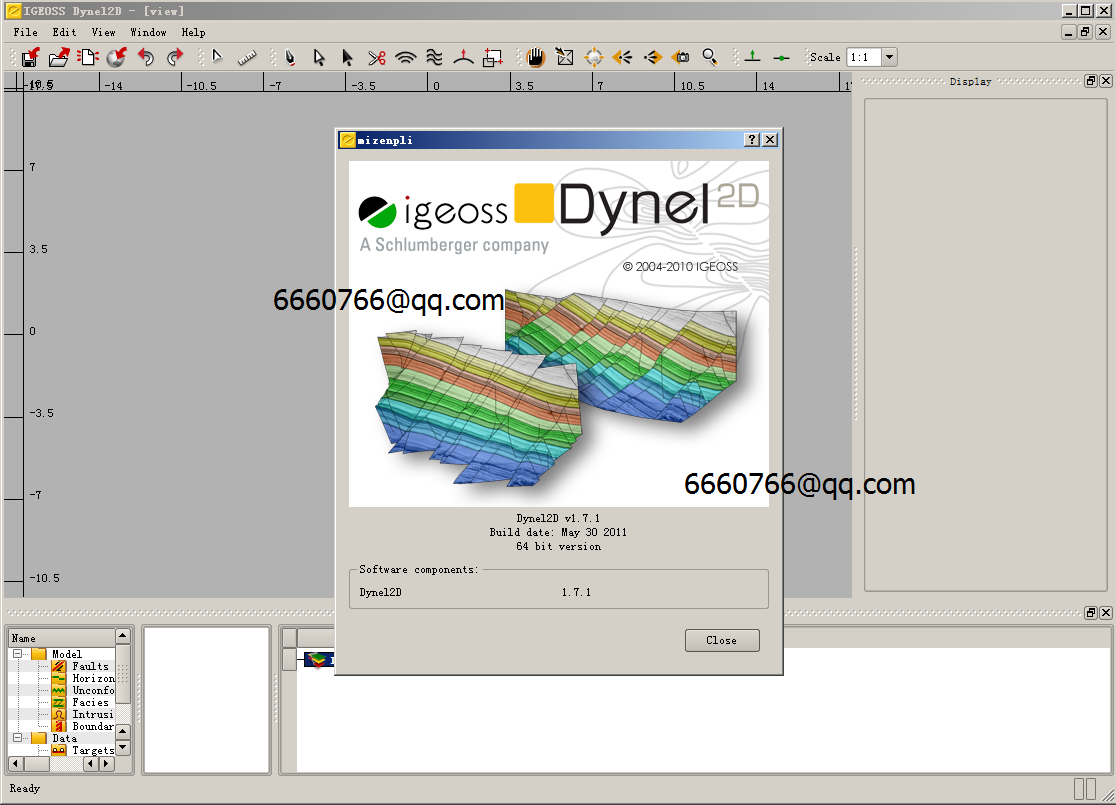
Dynel2D 1.7.0 is a major release of Dynel2D featuring better link with 3D modeling, usability and automation improvements and improved functionality when used as a pre-processor to Petroleum Systems Modeling. One of the main new features of Dynel2D 1.7.0 is its ability to start the workflow from an already built 3D surface model (e.g. imported from Petrel) and to perform several cross sections through this model. Dynel2D 1.7.0 also features several performance and robustness improvements.

Dynel2D 1.7.1 is a patch release that fixes stability problems that have been observed with (non commercial) version 1.7.0 of Dynel2D. It therefore does not contain any new features compared to 1.7.0. Note that complete forward and backward compatibility between projects created with both version has been preserved.
This section lists the main bug fixes and known problems of the current version of Dynel2D 1.7.1.

Dynel 3D is an easy to use restoration tool that allows to unravel the evolution of complex geological structures through time. Dynel3D can be used to build structurally and mechanically consistent faulted and folded structures, to validate and correct existing 3D models, to understand the development and evolution of sedimentary basins through geological time and to model sub-seismic faults and joints. The 2.2.0 version of Dynel3D comes with dramatic improvements in terms of stability and robustness of the application. Other major enhancements are related to the modeling of thin reservoirs (or thin layers), the flexibility of the faulted horizon modeling algorithm, the accuracy of the decompaction results and, last but not least, to the introduction of observation grids in Dynel3D. Observation grids are point sets, 2D or 3D grids that can be imported into Dynel, passively deformed by the restoration process, populated with properties computed during the restoration (displacements, strains and elastic stresses) and exported back to any other software application. Its improved robustness, ease of use, performance and flexibility make Dynel 2.2.0 the most powerful 3D restoration tool on the market.

下载地址:点些下载
download here?

发表在 地震资料解释软件, 正演反演软件 | 标签为 , , , , | Dynel 2D Dynel 3D已关闭评论

Gxplorer 2016 石文软件 2016

Gxplorer2016

Gxplorer是一基于Windows的油气勘探开发地质综合研究平台,该软件融油田数据管理、油气勘探开发地质研究和成果展示为一体,使油气勘探开发研究工作达到高度一体化、智能化,最大限度地降低劳动强度,提高研究工作效率;使研究人员摆脱机械、繁杂的手工劳动,有更多的精力研究地质问题、深化地质认识,提升研究水平。?Gxplorer具有清晰的数据管理功能,能方便、有效地管理钻井、录井、测井、岩心、分析化验、测试、分层、解释结果等各类井数据,能系统地管理各种研究成果,从而有利于研究工作和研究成果的积累,使地质研究逐步规范化。
Gxplorer以井资料地质研究为基础,能将各类井资料融为一体进行综合分析、处理和解释。平台提供了丰富的井资料研究手段,可以形成地层、层序、沉积相、储积层、生油层、盖层及油气水解释等多种类型的综合性图件。
Gxplorer拥有功能强大的剖面图自动绘制功能,能方便地生成符合地质规律、表现力强、美观的地层、砂体连通、沉积相、构造及油气藏等多种类型的剖面图。
Gxplorer提供了自动统计研究工区内包括砂层累计厚度、平均厚度、最大单砂层厚度、砂岩层数、砂/地比、砂/泥比、交替频率、油层厚度、储层孔隙度、渗透率、含油饱和度等多种参数的功能,大幅度减轻了劳动强度;Gxplorer提供了多种的网格化与等值线算法,并能对等值线图进行编辑,使其更符合地质规律。
Gxplorer平台还具有三维可视化显示功能,能使我们在(古)构造背景上直观地分析储层物性和含油气性的变化,强化图件的表现能力,使地质图件更加直观。
Gxplorer还可以作为研究项目过程管理的平台,是管理决策者及时了解、全面掌握项目实施过程、项目进展与项目成果的有效工具。
Gxplorer目前包含四个功能模块:?Ezwell(井数据处理、解释与成图)
Powersection(地层对比、连井剖面解释与成图)?Ezmap(平面数据管理与成图)?3Dview(三维显示)


文件大小:1DVD


发表在 地震资料解释软件, 绘图成图, 钻井测井软件 | 标签为 , , , , , | Gxplorer 2016 石文软件 2016已关闭评论

GOHFER 8.3.1.2

GOHFER8.3.1.2

发表在 采油试井压裂 | 标签为 , , , | GOHFER 8.3.1.2已关闭评论

cgg geovation 2015 6501 cgg geovation 2016 6601 geovation 2.0 2.1(2020) 2.2 (2022)

cgg6601_job

geovation? offers geoscientists a comprehensive set of processing modules and
applications to deal with all aspects of seismic processing. The software is a single portable
source code for all supported platforms, guaranteeing consistency from workstations to
supercomputers.
There are 503 processing modules designed to execute single or complex functions on a
seismic data flow (batch mode). Some modules have parallelized and optimized versions
for certain types of multi-processor computers or clusters.
A set of 23 graphic interactive applications or workstations provides users with
functions such as flow design, data analysis, parameter definition, event picking, velocity
interpretation, refraction statics, attribute QC, and so on.
geovation? runs both batch and interactive applications on PC/Linux equipment only.
JobManager is the operating environment that optimizes job distribution across
heterogeneous networks of machines and accesses datasets requested by programs
wherever they are on the network, through the Distributed Data Access Manager (DDAM).
The datasets stored on magnetic tapes are accessed through the Automatic Volume
Recognition (AVR) sub-system.
Importing and exporting seismic data (that is, formatted files) is managed with the AVR or
DDAM sub-system (or an HSM system in the case of data migration from/to tapes in a robot).
The Seismic Data Server (SDS) is a software package designed to make the management
of intermediate datasets (that is, data exchange with seismic jobs) entirely transparent to
the geoscientist.
The eXtended Processing Support (XPS) sub-system handles auxiliary data (trace attributes
such as elevation, static correction, gain, velocities, and QC results) in a database.
The geoscientist or site administrator can easily access the documentation for the
geovation? 2015 release through a browser. See Section 2.5, “Documentation”, p. 13
for more information.
Development Environment1 provides access to a comprehensive set of development tools
and documentation, for centers that develop their own modules and applications within
the geovation? environment.
In comparison to the previous geovation? 2013 release, there are 49 new batch
modules.
You will find in this document a short description of each function that is available to the
geoscientist or site administrator, within the geovation? working environment.

文件大小:3DVD

下载地址:点此下载

点此申请安装

点此申请培训

发表在 地震资料处理软件 | 标签为 , , , , | cgg geovation 2015 6501 cgg geovation 2016 6601 geovation 2.0 2.1(2020) 2.2 (2022)已关闭评论

norsar 2016.1

norsar2016.1_linux

发表在 正演反演软件 | 标签为 , , , , | norsar 2016.1已关闭评论

norsar 2016.1 windows and linux

norsar2016_windows

发表在 正演反演软件 | 标签为 , , , , | norsar 2016.1 windows and linux已关闭评论

drillbench2016.1.1

Blowout_controldrillbench2016.1.1

发表在 钻井测井软件 | 标签为 , , , , | drillbench2016.1.1已关闭评论

crystal 2016.2

crystal2016.2.15

发表在 地震资料解释软件, 正演反演软件 | 标签为 , , , , | crystal 2016.2已关闭评论